Machhapuchhre Model Trek
Photo: SPRASAPRADIP, CC BY-SA 4.0, Wikimedia Commons
Permit Details
The Annapurna Conservation Area permit is needed, at the official price. I arrange it with you before we leave Pokhara. Carry your passport and two photos.
Thank you.
Your review of Machhapuchhre Model Trek: Khumai Danda and Korchon under the Fishtail means a lot — I read every one myself.
Held for a quick check — it'll appear on this page once approved, usually within a day.
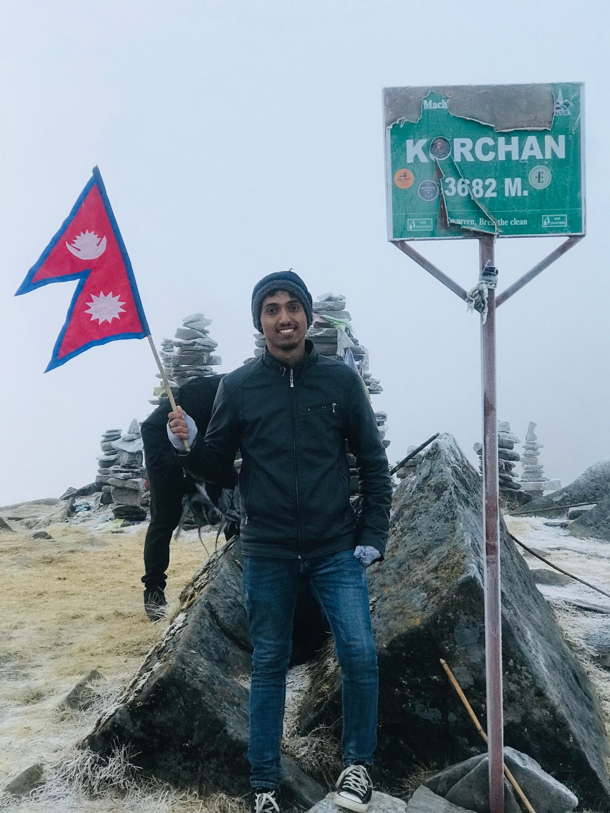
Five quiet days from Pokhara up the ridges east of Mardi Himal, to Khumai Danda and the viewpoint of Korchon, about 3,682 m, right under Machhapuchhre
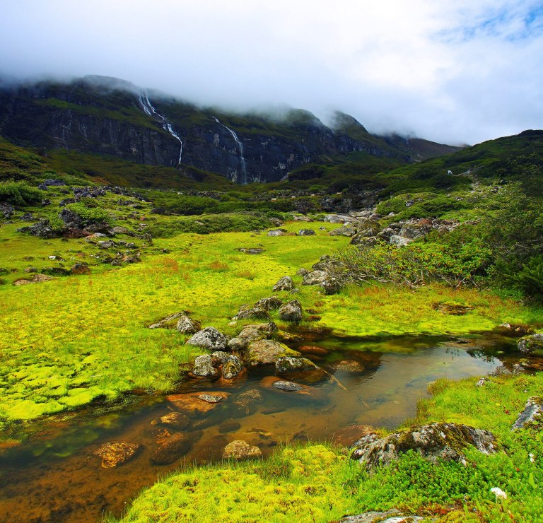
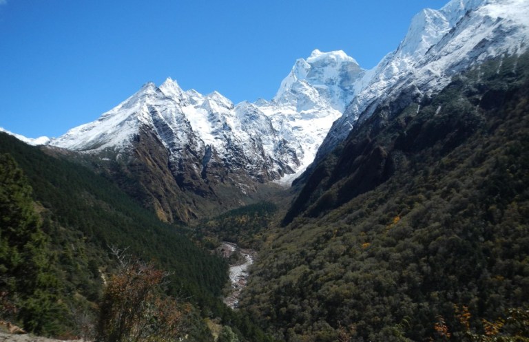
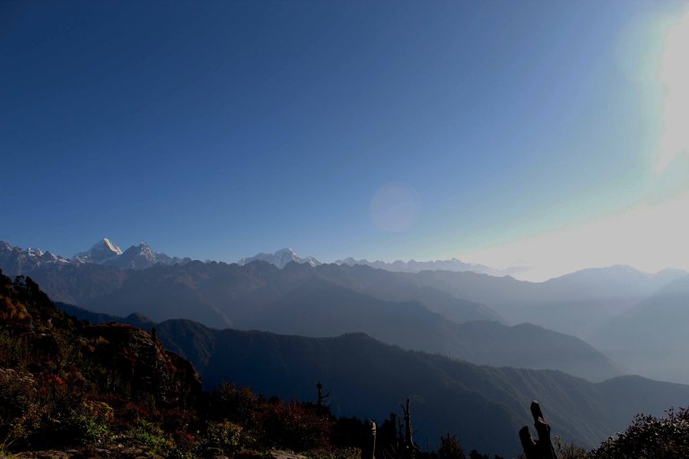
Machhapuchhre, the Fishtail, rises straight above Pokhara, and no one is allowed to climb it. This short trek goes as close as most people ever will: from the Gurung village of Ghachok up through forest and pasture to Khumai Danda, a grassy ridge at about 3,245 m, and on to Korchon, about 3,682 m, where Machhapuchhre, Annapurna and Mardi Himal stand right in front of you. It runs on the next ridges east of the Mardi Himal trail, with simple lodges and very few other walkers.
- Days
- 5 days
- Highest point
- 3,682 m
- Grade
- Moderate
- Best months
- Spring and Autumn
Jump to
A private trek
Your trek, walked at your own pace
Namaste, and welcome. This is not a group trek. It is just you and the people you came with, and me beside you every day, from Kathmandu and back. We walk at the pace your body likes, stop for tea or a view whenever you want, and nobody is waiting for you at the top. In the mountains I want you to feel looked after, and free.
- The same guide all the way
- One person to ask, for the trail, the lodges, the weather and anything that goes wrong.
- Your pace, not a group's
- Slow is fine; we walk the way you feel good.
- A rest day when you need one
- If your body asks for a day, we take it.
- Down when the body says so
- If you feel unwell with the height, we go down, never up.
- Quiet places when we can
- Quieter lodges and quiet hours on the trail.
 With warmth, Rujan Neupane
Just need a guide? $35 a day (for 1 to 5 people), on your own itinerary. Book me as your guide Rates and services
Along the way
The moments this route is known for.
- Machhapuchhre, close and from a side few people see
- Sunrise from Korchon, about 3,682 m
- Khumai Danda, a high grassy ridge
- Ghachok, an old Gurung village
- Rhododendron forest in spring
- A quiet alternative to Mardi Himal
How the trek climbs
From the day-by-day itineraryWe sleep at about 3,245 m on Khumai Danda and walk up to about 3,682 m at Korchon in the morning. That climb from Pokhara is fast; we go slowly, and if anyone feels unwell we stay lower.
Is this walk for you?
An honest answer before you book anything.It suits you if…
- You want close views of Machhapuchhre in a few days.
- You found Mardi Himal or Poon Hill too busy.
- You can walk 5 to 6 hours, mostly uphill.
- You are happy with simple lodges.
Think twice if…
- You want comfortable lodges.
- You want a busy trail with many tea stops.
- You have heart or lung problems at altitude; please ask me first.
Not sure? Tell me how you usually walk, and I'll tell you honestly. Write to me
The route as I walk it
This is how I usually walk it, slowly. It is an example, not a fixed package: we plan the days together, around you, the season and the weather.
-
Day 1
Pokhara to Ghachok, walk to Hile Kharka
Night 2,160 mA short drive north of Pokhara to Ghachok, then up through villages and forest to Hile Kharka. About 1 hour by road, 3 to 4 hours on foot.
-
Day 2
Hile Kharka to Khumai Danda
Night 3,245 mUp through forest and pasture by Chichimle Kharka to the ridge of Khumai Danda. About 5 to 6 hours.
-
Day 3
Up to Korchon, down to Meshrom Kharka
Night 2,690 m Up to 3,682 m Highest pointBefore dawn up to the viewpoint of Korchon for sunrise, then along the ridge and down to Meshrom Kharka. About 5 hours.
-
Day 4
Meshrom Kharka to the road, drive to Pokhara
Night 822 mDown through forest and villages to the road at Tokro or nearby, and back to Pokhara. About 4 to 5 hours on foot, then 2 to 3 hours by jeep.
-
Day 5
A spare day
Night 822 mKept for cloud, rain or tired legs: a second morning on the ridge, or a quiet day in Pokhara.
More about this walk
The trail in detail
The route
From Pokhara a short drive goes north to Ghachok, a Gurung village at about 1,255 m. The trail climbs through farmland and forest to Hile Kharka, about 2,160 m, and on to Khumai Danda, a high grassy ridge at about 3,245 m. Early next morning a path climbs to Korchon, about 3,682 m, a viewpoint facing Machhapuchhre, Annapurna and Mardi Himal. The way down goes by Meshrom Kharka, about 2,690 m, to the road.
The mountain no one climbs
Machhapuchhre, about 6,993 m, is held sacred, and the government does not give permits to climb it. The summit has never been officially reached. From Korchon you see its double top, the fishtail that gives it its name.
The ground and getting ready
Forest trail, steep in places, then open grassy ridge. No pass and no glacier.
In the months before, walk hill days of 5 to 6 hours.
People and places on the way
Gurung villages lower down. Greet people with namaste and ask before photographing. Some of the lodges on the ridge were built with village support; what you pay stays in the hills.
The honest downsides
What I'd want to know before walking it.- Few and simple lodges; some may be closed outside the seasons.
- A fast climb in two days from about 1,250 m to over 3,200 m.
- The ridges are exposed to wind, and cold at night.
- Clouds often hide the mountains by mid-morning; the views are at dawn.
The pace
How long we walk each day, and where we stop.- On foot each day
- 3 to 6
- Rest and acclimatisation days
- None needed
Days you can add
- A second night on Khumai Danda
- On towards Mardi Himal
- A night in Ghachok
If you walk with a camera
Sunrise from Korchon is the reason to come; we plan the nights for it.
A day on the trail
An ordinary walking day. Times shift a little with the season and the day's distance.- 06:30Tea and breakfastPorridge, eggs or chapati. Bags packed for the day.
- 07:30WalkingCool air, the clearest mountain views of the day.
- 10:00Tea stopA break in a village, water bottles refilled.
- 12:00LunchDal bhat or noodle soup in a lodge on the way.
- 14:30Arrive at the lodgeMost days end by mid-afternoon, before clouds build.
- 16:00Free timeWash, rest, wander the village, a short walk up.
- 18:30DinnerWarm dining room, tomorrow's plan, early night.
On Korchon we start before dawn: the mountains are clearest in the first hour.
When to walk it
March to April for rhododendrons, October to November for clear air.- GoodJAN
- GoodFEB
- BestMAR
- BestAPR
- GoodMAY
- WetJUN
- WetJUL
- WetAUG
- WetSEP
- BestOCT
- BestNOV
- GoodDEC
Quiet months This trail has company in every walking month; the start of each season is calmest.
- January: monsoon
- February: monsoon
- March: monsoon
- April: monsoon
- May: monsoon
- June: monsoon
- July: monsoon
- August: monsoon
- September: monsoon
- October: monsoon
- November: monsoon
- December: monsoon
In winter the ridge can have snow and some lodges close; in the monsoon the trail is muddy and the view mostly hidden.
Good to know
The small practical things people ask me most.- Licensed guideSince April 2023 foreign trekkers in most of Nepal must walk with a licensed guide.
- MoneyNo cash machines on the trail. Carry rupees in small notes for lodges, homestays, showers and charging.
- PhoneSignal is patchy or absent in places. I carry a way to call for help where there is none; ask me.
- WaterRefill from lodge or village taps and treat it with tablets or a filter. No plastic bottles needed.
- Join it with Mardi HimalThe two ridges are close; ask me about a longer walk.
Full details in Packing list and Permits.
Practical
Permits and paperwork
Open zone: no restricted-area permit needed
- Region
- Annapurna Region
- Province
- Western Development Region
- Zone
- Gandaki Zone
- District
- Kaski
Official information: Department of Immigration, Nepal
What to pack
Everything a teahouse trek needs is in my packing list: Nepal Trekking Packing List: What to Bring (and What Not To) →
For multi-day mountain treks reaching up to about 5,500 m with gradual elevation gain.
Safety on the trail
- Licensed & Trained Guide Your safety is the foundation of every trip I lead. I am licensed by the Government of Nepal as a trekking guide (licence no. 18550) and a tour guide (licence no. 4606), and trained in first aid, basic rescue and trekking-based search and rescue. I check your gear and the weather before every stage, so you can enjoy the trek with peace of mind. For groups larger than four, I bring in additional government-licensed guides I have worked with before.
- Health & First Aid Certified Wilderness First Responder: I hold up-to-date certifications in Wilderness First Aid and CPR, ensuring I am fully trained to handle medical emergencies, injuries, and illnesses in remote terrain. Proactive Health & Altitude Tracking: Your safety is my daily priority. I monitor your pulse, oxygen saturation (SpO2), and acclimatisation levels daily using a pulse oximeter to catch early signs of Altitude Sickness (AMS). Fully Stocked First Aid Kit: I carry a comprehensive medical kit on every trek, equipped with essential medications, wound dressings, and emergency response supplies tailored to the route. Established Emergency & Evacuation Protocols: I maintain clear protocols and direct lines of communication for medical evacuations, including swift coordination with helicopter rescue teams if severe conditions arise. Strict Hygiene & Safe Water Standards: I ensure clean, safe drinking water throughout the trail and verify strict hygiene practices during all meal breaks to protect you against waterborne illnesses. Personalised Care & Medical Attention: Before we step onto the trail, I review any health concerns or allergies you may have so I can cater to your needs and adapt our pace accordingly.
- Communication Satellite & Emergency Communication: I carry a reliable satellite messaging device (such as a Garmin inReach) to stay connected in remote areas with no cellular coverage, allowing for real-time location tracking and instant SOS capabilities. Daily Family & Loved One Updates: When signal or satellite access allows, I provide regular updates to your emergency contacts or loved ones so they always know you are safe and on schedule. Transparent Route & Weather Briefings: Before we set off each day, I conduct clear briefings on the upcoming terrain, expected weather conditions, trail milestones, and safety protocols. Open & Encouraging Dialogue: I foster an environment where you can freely express how you’re feeling—whether you're experiencing fatigue, discomfort, or symptoms of altitude—without hesitation or judgment. Direct Operations & Rescue Contact: I maintain continuous connectivity with ground support, local lodge networks, and emergency rescue services to coordinate logistics seamlessly if plans need to adjust.
- Route Experience Deep Local & Trail Knowledge: Having navigated these routes extensively across varying seasons, I know the terrain, trail conditions, hidden hazards, and optimal rest spots in intimate detail. Flexible & Adaptive Itineraries: I constantly evaluate trail status, weather patterns, and team energy levels, making smart, real-time adjustments to our daily pace or route to avoid risky conditions. Smart Pace & Acclimatisation Management: I set a steady, sustainable pace (bistarai, bistarai) designed specifically to promote proper altitude adaptation and prevent physical burnout. Vetted Rest Stops & Accommodation: I choose reliable, high-standard teahouses, campsites, and lodge networks along the route, ensuring safe, hygienic, and comfortable places to rest every night. Terrain & Environmental Hazard Navigation: From loose scree and river crossings to icy passes and rockfall zones, I guide you through technical and treacherous trail sections with hands-on support and proper technique.
- Daily Health Check Morning & Evening Health Checks: I conduct routine health check-ins every morning and evening to track how your body is adapting to the altitude, workload, and changing climate. Vital Signs & SpO2 Monitoring: Using a medical-grade pulse oximeter, I measure your blood oxygen levels (SpO2) and heart rate twice daily to spot early, subtle signs of Acute Mountain Sickness (AMS). Lake Louise Scoring System: I utilize the standardized Lake Louise Score card to systematically assess symptoms like headache, fatigue, nausea, and sleep quality, taking the guesswork out of altitude safety. Hydration & Appetite Tracking: I monitor your daily fluid intake and meal consumption, ensuring you stay properly hydrated and sufficiently fueled for tough trekking days. Early Intervention & Action Plans: If any health metrics or symptoms dip, I take immediate, preventive action—whether that means adjusting our daily pace, adding a rest day, or initiating a controlled descent.
- Emergency Evacuation Direct Helicopter & Ground Coordination: In the event of severe illness or injury, I maintain direct contact with local helicopter rescue operators and ground transport services to arrange immediate, rapid evacuation. Insurance Verification & Claims Support: Before setting out, I review and verify your high-altitude travel insurance details so rescue protocols can be triggered instantly without bureaucratic delays. Rapid Medical Evacuation Protocols: I carry standard, high-altitude emergency protocols to prepare and stabilize you quickly, ensuring a swift transfer to the nearest medical facility or hospital in Kathmandu. Constant SOS Satellite Connectivity: Using my satellite messaging device, I can trigger a 24/7 global emergency SOS and send exact GPS coordinates to search-and-rescue teams, even in complete dead zones. 24/7 Ground Operations Backing: I work alongside an experienced city-based support team that coordinates hospital admissions, logistics, and communication with your insurance provider and loved ones while I manage the evacuation on-site.
For your budget
My guide fee for this walk is about $ 35 a day, the same for 1 to 5 people.
A porter, if you hire one: about the same as a guide's day rate. Permits, transport, rooms and meals are paid separately, at cost.
I don't sell packages. I guide, and I help you arrange the rest (rooms, transport, permits) at what it actually costs. If you would like it all put together as one package, ask me: I make one only on your request, and we confirm it by email.
Where your money goes
Every cost of this trek, who receives it, and nothing hidden.| What | Who receives it | Amount | Note |
|---|---|---|---|
| Guide (me) | Rujan Neupane | My day rate × 5 days | One rate for 1 to 5 people |
| Annapurna Conservation Area permit | The conservation area (ACAP) | Official price | Paid at cost |
| Jeep Pokhara–Ghachok, and from the road end back | The jeep owners | Agreed before the trek | Paid at cost |
| Porter, if you want one | The porter | His day rate | Paid to him |
| Lodges, homestays and meals | Families on the trail | What they charge | You pay them directly; I never add anything |
Trip documents
Made from this page, always up to date. Download and print, or keep them on your phone.
Walking gently
How we leave the trail as we found it.- Refill, don't buyPurified water in the villages instead of plastic bottles.
- Stay with familiesWe sleep and eat in locally owned lodges, so the money stays in the valley.
- Quiet respectWalk clockwise around stupas and prayer walls, and ask before taking photos of people.
- Carry it outWhatever we bring up, we carry down again.
My promises
Written down, so you can hold me to them.- No pressureAsk me anything. Asking costs nothing and commits you to nothing, and I will never rush your decision.
- Nothing hiddenEvery cost is written down before you pay anything, and nothing is added later without your agreement.
- When I'd say noIf the season, your fitness or the weather make a trek unsafe, I'll tell you plainly and suggest something better.
- Reviews as writtenEvery review here is published as the trekker wrote it. I don't edit reviews or remove critical ones.
Before you walk it
What I would read first, from my own guides and walks.Guides to read first
Frequently asked questions
How high does it go?
About 3,682 m at Korchon; the highest night is about 3,245 m on Khumai Danda.
How is it different from Mardi Himal?
It runs on the next ridges east, closer under Machhapuchhre, with fewer people and simpler lodges.
Can I climb Machhapuchhre?
No. It is closed to climbing.
Do I need a permit?
Yes, the Annapurna Conservation Area permit.
Are there lodges?
Simple ones; some may close outside the seasons.
When is best?
March to April and October to November.
Reviews from trekkers who walked with me are published automatically, exactly as they wrote them. Reviews sent through the open form are checked for spam only.
Reviews
0 reviewsNo reviews yet. Be the first to share how your trek went.
Share your experience
Walked this route with me? Your review is held for a quick check before it's shown here.
Plan it with me
Tell me how you'd like to walk it. I'll plan the rest around you.
Send your dates, group size and anything you'd like to change, whichever way suits you.
- +977 984-3808583
- Phone
- +977 984-3808583
Prefer to shape it yourself? Plan it step by step
More than 5 of you? Write to me. I guide up to 5 people at one rate. For a bigger group we can talk it through by email. I reply myself, usually within a day. On the trail there is often no network, so it can take a few days.
Verified credentials
My licences and training papers. Open any file to see the original.
Guide Association Membership
Write to me about this trek
Enquiring about: Machhapuchhre Model Trek: Khumai Danda and Korchon under the Fishtail — tell me your dates and group size and I'll write back myself, with what I know about your dates and the real costs.
How I grade my treks
Every trek I guide is rated one of 4 grades, based on altitude, daily walking time, terrain, and the experience it takes to enjoy it comfortably.